Happy Trails
A gourmet guide to hiking and biking…
Many of the best hikes in the North State involve water in some form: Grand, sweeping views of Lake Shasta or Lake Siskiyou; the stunning waterfalls along the McCloud River; or the simple pleasure of walking beside the churning waters of a creek.
• The Waters Gulch Trail just south of Redding offers stunning views of Lake Shasta. On this three-mile hike, you’ll also encounter a stretch of the trail that skirts along the small waterfalls of Waters Gulch Creek. To get to this trail, you take the Packers Bay Road turnoff off I-5 and head west to a small dirt parking lot on your right about a mile from the freeway, where you’ll see the sign marking the Waters Gulch trailhead. The trail ends at the parking lot for the Packers Bay boat launch, and you’ll have to hike about a mile on Packers Bay Road to get back to your car.
• Another hike featuring Lake Shasta is the three-mile Bailey Cove Trail loop that you access by taking the Shasta Caverns exit off I-5. You’ll enjoy vistas of the lake from a number of different perspectives, as well as a look at the sprawling Holiday Harbor marina on the north side of the trail. There is an $8 fee for the use of the parking lot at the trailhead.
• Feeling ambitious? There’s the eight-mile hike or bike around Lake Siskiyou, featuring the lake framed by mountain ranges. If you want a shorter hike, try the two-miler along the lake’s north shore. The views are spectacular, and there are benches along the trail where you can relax, take in the view and have a snack. The best access point is the parking lot across from the Mount Shasta Resort tennis courts along W.A. Barr Road.
• There’s one sure way to impress out-of-town visitors: Take ‘em for a hike on the trail along the McCloud River, starting at the spectacular Lower Falls with its popular swimming hole, then on to the Middle and Upper Falls. The 5.4-mile stretch can also be biked along a paved road that skirts alongside the river. Take Highway 89 east from McCloud and look for the sign for the river and the falls 5.5 miles out of town, then make a right turn and drive the short distance to the Lower Falls.
• The Hedge Creek Falls trail at the north end of Dunsmuir is a short, fun hike that actually takes you to a spot just behind the falls, where you can practically reach out and touch the cascading water. You can hike a little farther to a viewing platform that looks out over the Sacramento River, and, beyond that, a recent extension of the trail takes you right down to the river’s edge. To get to this trail, drive north on Dunsmuir Avenue to the water bottling plant on the north end of the town. The Hedge Creek Trail is next to it, and there’s a parking lot across the street.
• Another short Dunsmuir hike starts at Tauhindauli Park just north of downtown. There’s a paved trail there along the Sacramento River that at its north end turns into a dirt trail skirting along the river to Dunsmuir’s City Park. There’s a kids’ playground there, a gazebo where you can sit and watch the river roll by, and the Botanical Gardens.
• Another riverside hike starts at Caldwell Park in Redding, where it’s a short hop from the parking lot to the bike trail along the river. You can hike or bike from there the one mile to the iconic Sundial Bridge. Along the way, you’ll pass the small lagoon and the colony of turtles that gives Turtle Bay its name.
You can also hike or bike in the opposite direction along the river all the way to Shasta Dam, where you’ll find the Upper Sacramento Ditch Trail on the east side of the river between Shasta and Keswick dams. The trail, nine miles long in each direction, is lined with bay and oak trees, and dashes of color from the red berries of the toyon bush.
• Other Redding hiking trails can be found at the McConnell Foundation’s Lema Ranch headquarters near the intersection of Shasta View Drive and Hemingway Drive. There you’ll find about eight miles of paved and unpaved trails, and ponds where ring-necked ducks and wigeons abound.
• Another magnet for birdwatchers is the 1.5-mile Clover Creek Trail in east Redding just off Shasta View Drive. This one also features ponds and migrating ducks, herons and egrets. Many of the herons and egrets stay in the ponds all year round.
• You’ve got a good chance of spotting bald eagles on the six-mile roundtrip Davis Gulch Trail that skirts along the south side of Whiskeytown Lake. The eagles fly over the lake, looking for prey. The hike starts at the Brandy Creek parking lot.
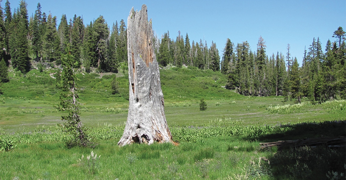
• Once the snows melt in Lassen Park, you can go wildflower hunting on a five-mile round trip to and from Paradise Meadow. You access the trail off Highway 89 from the north end of the park. Look for the parking lot immediately on the left after you cross Hat Creek. The trail follows Hat Creek to its headwaters at the meadow, where you’ll find Indian paintbrush and orange-and-black tiger lilies, among other colorful wildflowers.
• You don’t have to climb all the way to the top of Mount Shasta to enjoy the magic of its mountain scenery: You can drive up to the halfway point, to Panther Meadows at 7,500 feet, and a short hike that features an array of wildflowers that include Indian paintbrushes and the bluish-white blossoms of wild onions. If you want a longer hike, you can keep on going upward to South Gate Meadows, where you’ll find more wildflowers and some enchanting waterfalls.
• Lower down on the mountain, just off Everitt Memorial Highway, is the 10.7-mile Gateway Trail whose frequent switchbacks make it a challenging and popular ride for mountain bikers.
• The 40-mile Great Shasta Rail Trail goes through the Shasta-Trinity National Forest, starting at McCloud and going all the way to Burney. The trail is good for hikers, equestrians and mountain bikers, but a bit too rough for road bikes.
• The Redding area is a mountain biker’s paradise, featuring hundreds of miles of trails. A good starting point is the Swasey Recreation Area, off Swasey Drive, where you’ll find trails for both beginning and intermediate level bikers.
• Another good launching spot for mountain biking is the Hornbeck Trail parking lot off Quartz Hill Road near the Keswick Dam Reservoir. You’ll find trails there that are just right for beginning cyclists.
There are many more trails for you to enjoy in the North State, of course, but these will help get you started for some great outdoor adventuring this year.
By Tim Holt
Photo by Jay Thesken


